
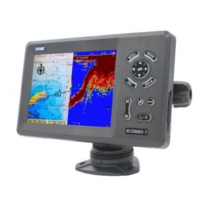
GPS Plotter with Echo Sounder
Minimum configuration:
Plotter characteristics:
Waypoints/icons: minimum 12,000 user points,
Routes: up to 30 waypoint routes, each with up to 170 points,
Tracks: minimum 8,000 automatic track log points, 10 saved tracks
Palette: Normal / Daylight / Sunlight / Night in dark environment / NOAA chart paper colors
Plot interval: 1 second to 99 hours or 0.01 nm to 9.99 nm.
Plot scale: 0.01 nm to 1,000 nm
Perspective display: On/Off
Sky: Sunrise/Sunset/Moonrise Physical:
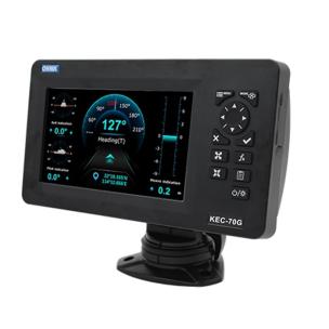
Display: 7-inch color TFT day-view LCD
Receiver characteristics
GPS receiver: minimum 50 continuously operating parallel-channel GPS receivers
Interface: NMEA 0183 input and output, RS232 output
AIS interface: Data input: NMEA 0183, RS232.
Echo sounder: Range base: Meter* 5/10/20/40/80/150/200/300/500/1000 meters, feet, fathoms/p braza can be changed in the system menu
Range shift: up to 1000 meters
Display modes: High frequency (200K), Low frequency (50K), Dual (200K and 50K 1/2 display respectively), Zoom (200K and 50K zoom), and A-scope display
Zoom display: Marker zoom, bottom zoom, and bottom lock expansion
TX frequency: 50 and 200 kHz
Power output: minimum 550W
Transducer: minimum 250W plastic thru-hull, dual frequency 50/200 kHz.